
Detecting Resources
Map Tools: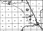 Here are links to different map tool available on the internet giving you the power
to research a new site to detect. If you know of a web site that should be added please
email addme@detectingresearch.com and our web master will add the site to our list.
Here are links to different map tool available on the internet giving you the power
to research a new site to detect. If you know of a web site that should be added please
email addme@detectingresearch.com and our web master will add the site to our list.Map Tools:
- GAIA GPS
offers a number of tools to discover new detecting locations. Membership is free but they also offer a
premium membership that includes historical topographical maps. GAIA GPS is also available on the Apple and
Google app stores so you can create maps on your compute, save them to the cloud and access them in the field on your
smart phone.
Click Here to launch GAIA GPS
- Historical Aerials has aerials and topos selectors, the atlases will let you view additional historical representations of the viewing area. They offer geo-referenced digitized versions of historic maps and property boundary documents. What makes Historical Aerials unique is the ability to zero in on an map area and then go back in time to see how that area on the map changes over time. There is a selection of topo maps for most of the US and you can buy a monthly subscription (that gets rid of the ads that appear all over the site) or individual maps. Click here to launch Historical Aerials
- LandGlide The most advanced and comprehensive parcel data and property line map application. Using GPS to pinpoint your location, access key parcel data anywhere. LandGlide gives you access on all your devices. LandGlide
- LUNA Digital Asset Management Software: LUNA is a web-hosted software solution developed to display, manage and preserve all types of digital archive collections, image collections, special collections and library collections. The LUNA software is ideal for image files, video files, audio files, PDFs, books and manuscripts. LUNA offers a unique section called Collections in LUNA where you can find online map resources.
Click her to access the Collections in LUNA and explore!
- Magic Earth
Magic Earth is a 3D mapping app (not available for desk top) tool that lets you view 3D maps bringing a new dimension to the maps, a much better map experience and context of the road ahead. Click this link to go to Magic Earth web site and get the app (scroll all the way to the bottom of their web page) for your phone.
- MapQuest
Here is another mapping tool that can provide you with information, MapQuest can provide details that will help you. MapQuest
- Old Maps online Old Maps Online indexes over 400.000 maps. This is only thanks to the archives and libraries that were open to the idea and provided their online content. All new participants are warmly welcomed.
Click her to access Old Maps online, check out the "Find a Place" button.
- Omnimap Omnimap has over 200,000 map items on our web site and is one of the world's largest specialty retailers of paper and digital maps, hiking guides, map pins, flags, and more. Our specialty is international maps and we offer topographic maps, travel maps, and wall maps for nearly all countries and regions of the world. We also offer over 100,000 topographic, road, and city maps and atlases for of the USA.
Click her to access the Omnimap map collection.
- USGA Maps USGA is the largest civilian mapping agency, USGS collects, monitors, analyzes, and provides science about natural resource conditions. Their diverse expertise enables them to carry out large-scale, multi disciplinary investigations and provide impartial scientific information to resource managers, planners, and other customers.
Click her to access the USGS web site.
USGA Topo Maps USGA Topo Maps is a really cool site where you can zero in on a town, city etc. then find a point in the highlighted area, click your mouse anywhere in the area and get a listing of available topo maps for that area from 1880 to 2021.
Click her to access the USGS Topo Maps web site.
USGS Historical Topographic Map Explorer The USGS Historical Topographic Map Explorer is very easy to use, simply find a place you want to explore, then click on a location to see its historical maps. Its that easy!
Click her to access the USGS Historical Topographic Map Explorer.
- Historical Aerials has aerials and topos selectors, the atlases will let you view additional historical representations of the viewing area. They offer geo-referenced digitized versions of historic maps and property boundary documents. What makes Historical Aerials unique is the ability to zero in on an map area and then go back in time to see how that area on the map changes over time. There is a selection of topo maps for most of the US and you can buy a monthly subscription (that gets rid of the ads that appear all over the site) or individual maps. Click here to launch Historical Aerials
Detecting Research Home
Happy Detecting!

|
Below are some great tools to help you get more out of you detecting adventures. |
Research Tools: