
Detecting Resources
Geographic Information System (GIS)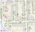 A geographic information system (GIS) is a system designed to capture, store, manipulate, analyze,
manage, and present all types of geographical data. The key word to this technology is Geography - this
means that some portion of the data is spatial. In other words, data that is in some way
referenced to locations on the earth.
A geographic information system (GIS) is a system designed to capture, store, manipulate, analyze,
manage, and present all types of geographical data. The key word to this technology is Geography - this
means that some portion of the data is spatial. In other words, data that is in some way
referenced to locations on the earth.
GIS Resources:
- ArcGIS Pro
the powerful single desktop GIS application, is feature-packed software developed with enhancements
and ideas from the ArcGIS Pro user community
- GmapGIS let you draw on Google maps creating labels that you
can save and share.
- GISMAPS lets you locate free GIS maps and property maps in state, county,
and local government offices.
- Mango lets you make Amazing Interactive Web Maps That You
and Your Users Will Love!
- GIS On Line Searches
lets you find mapping and GIS Records Resources by State.
- USGS GIS Mapping
USGS is a primary source of geographic information system (GIS) data. Our data and information is presented
in spatial and geographic formats, including The National Map, Earth Explorer, GloVIS, LandsatLook, and much more.
Detecting Research Home
Happy Detecting!

|
Below are some great tools to help you get more out of you detecting adventures. |
Research Tools: